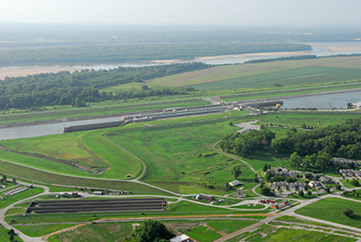
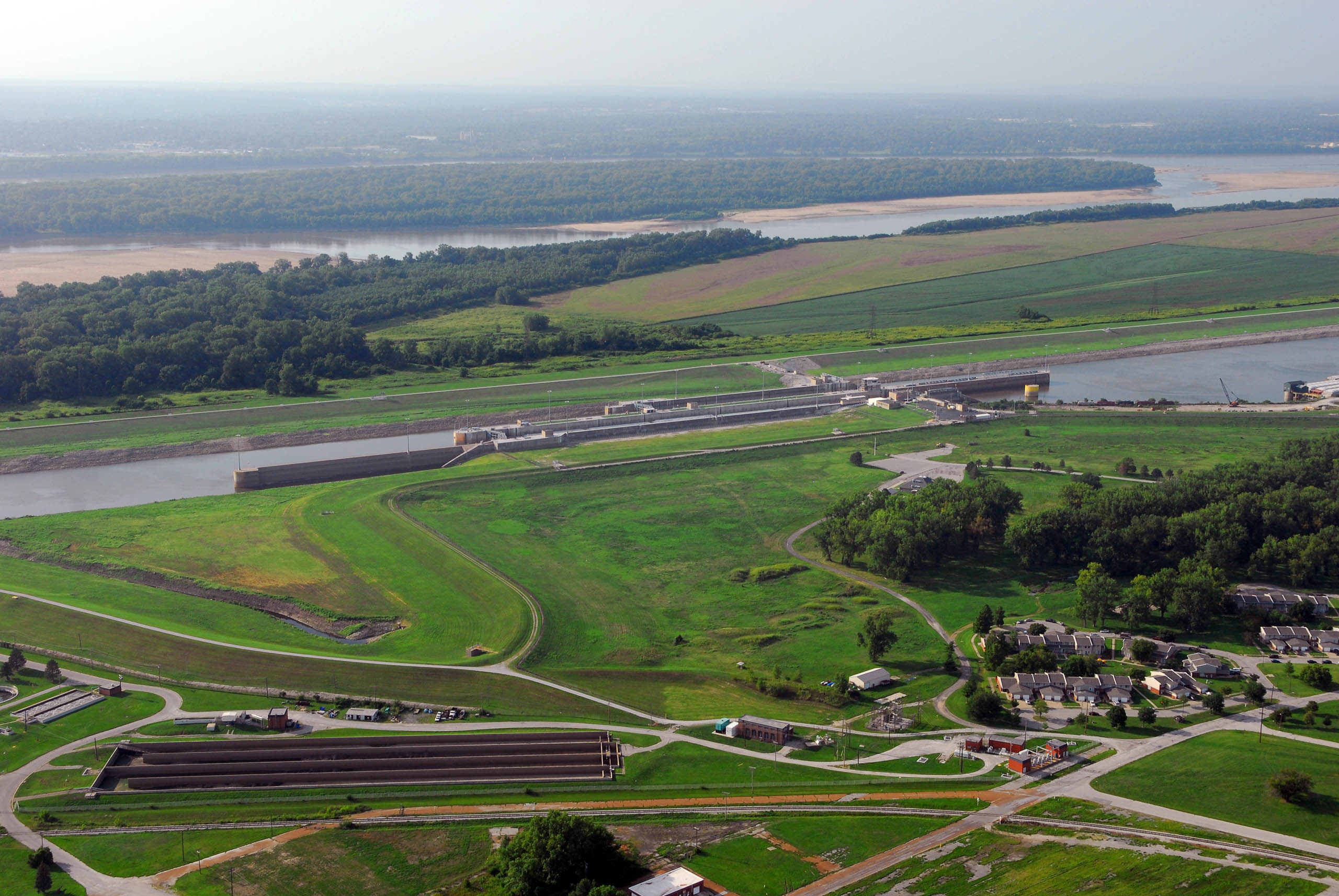
At the south end of the Chain of Rocks Canal is Lock No. 27, the last (or first, depending on which way one is counting) of the lock complexes on the Mississippi River. South of here, the river is completely free-flowing all the way down to the mouth of the river in New Orleans. On the Mississippi, locks start their numbering in the north and increase going south, with Lock No. 1 located on the river between Minneapolis and St. Paul. In an inverse of this numbering system, the river's length is charted in ‘river miles’ measured from the south to the north—with the river being broken into an upper and lower half. The Upper Mississippi River is measured northward from the confluence of the Ohio and the Mississippi Rivers at Cairo, Illinois, and Lock No. 27 is situated at river mile 185.5 of this northerly system. The zero marker for the lower portion is measured from the Head of Passes—a point where the main stem of the Mississippi splits into three branches at the Gulf of Mexico. River miles are a measure of the historic thalweg—the lowest lineal points in elevation along a river's watercourse. Additionally, this final/first lock is situated just below the confluence with the Missouri River, and as such Lock No. 27 moves more cargo than any other navigation structure on the Mississippi River—with an average of about 10,000 lockages a year.
Completed in 1953, it was the final piece in the US Army Corps of Engineers’ all-important navigation mandate: maintain a continuous 9-foot channel across the length of the river. The lock works in conjunction with a low-water, immovable rock dam across on the main channel of the Mississippi River near the Old Chain of Rocks Bridge (now Chain of Rocks Road). This dam, known alternately as Dam No. 27 or Chain of Rocks Dam, is often confused with the “chain of rocks” itself. This man-made feature raises the level of water above it—and crucially, in the canal as well—by three feet, thus limiting the amount of excavation that had to be done by just that much.