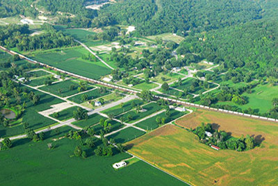
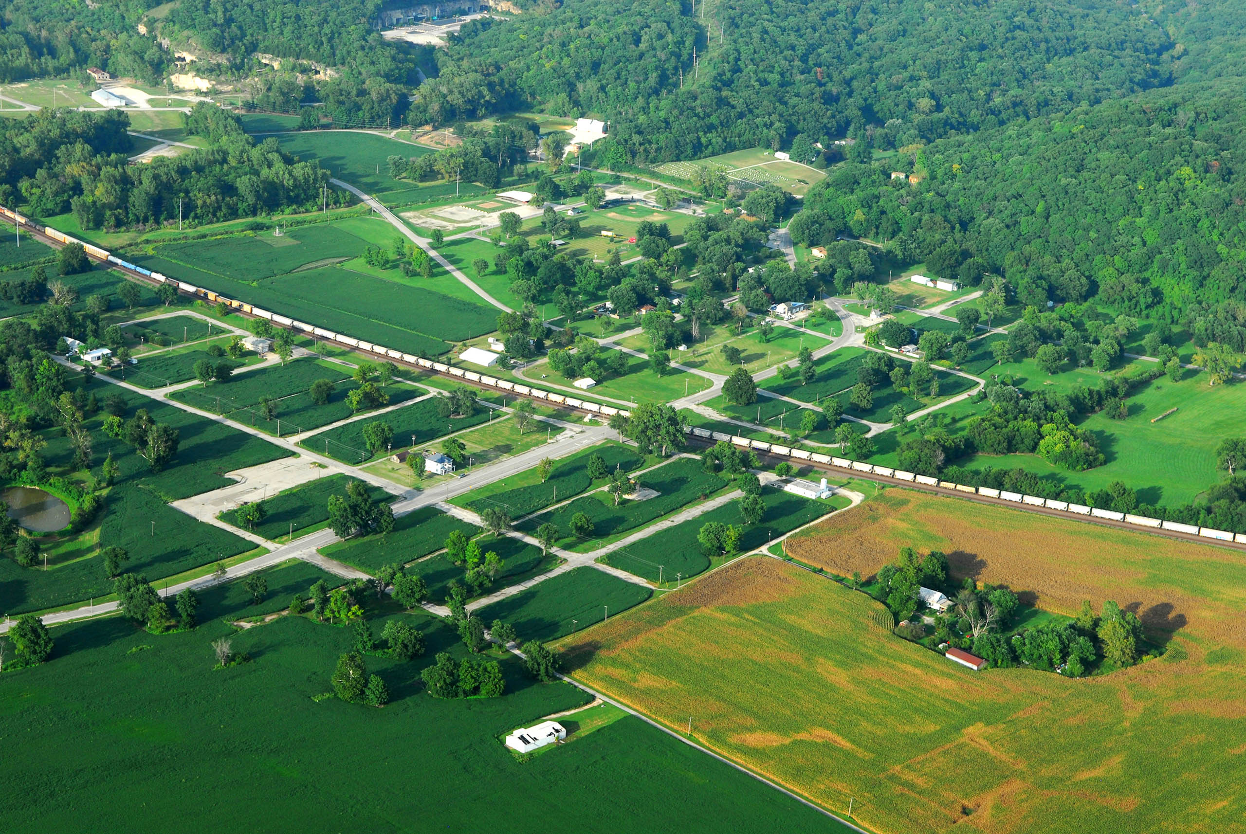
Early in the morning of August 1, 1993, the Mississippi River breached an agricultural levee near Columbia, Illinois, north of Valmeyer, causing residents to evacuate to higher ground. At peak flood state, the town stood under as much as 16 feet of water; in its wake, 90 percent of the homes, farmhouses, and commercial structures were damaged beyond repair. Within weeks, the Federal Emergency Management Agency (FEMA) began the process of buying out homeowners and leveling these structures. The citizens of Valmeyer successfully relocated the community to a bluff two miles west, complete with new homes, schools, and public facilities. Two dozen households remain on the former Valmeyer site, alongside a remaining grid of streets. Much of “Old Valmeyer” is now empty fields or agricultural ground. Each summer, cornfields cover the former site of Valmeyer Elementary.
Today Valmeyer is a hybrid, divided city. The older section lies in the American Bottom, missing many buildings but retaining a street grid, a park, and other vestiges of settlement that survived the 1993 flood; the newer section is 400 feet atop the bluff, representing the new Valmeyer that was built for some $35 million after the flood. Once this section sported a sign reading “Valmeyer II: A New Beginning, ” inscribing the sequential nature of this place. Twenty years later, however, new Valmeyer seems settled, and its authenticity no longer questioned. The relationship between the two halves has receded, so that old Valmeyer is more like the once-was towns of the American Bottom—places that lost population through changes in human systems, not due to natural attack.
Old Valmeyer, platted in 1909 and named for a Swiss family (in German, valley of the Meyer), arose to provide housing for workers at a large stone quarry adjacent to the town. The Iron Mountain Railroad began constructing a rail line to Chester through Valmeyer after 1900. Previously, the only rail route through Monroe County passed diagonally southeast through Waterloo. Construction of the Iron Mountain necessitated ample crushed limestone, and the provident bluff was well suited. The quarry necessitated massive cuts into the bluff in the room and pillar fashion. Eventually the railroad was built, and the line later sold to the Missouri Pacific.
The quarry passed into the ownership of the Columbia Quarry Company, which maintained operations through 1937. In 1921, the quarry reported extracting 1,000 tons per day. Most of the rock went to agricultural use in the last two decades of operation. Valmeyer thrived as workers built houses along its streets. In the 1930s, with state and federal assistance, a grand Art Deco public school was built, replete with zigzag terra cotta ornament. Even after the quarry scaled back, its new life as an indoor mushroom farm (open through 1983) provided employment. When the flood waters first threatened the town in August 1993, Valmeyer was a well-kept, well-loved historic place.
Flooding captured a town that had not yet met its centennial, although this was not the first such instance on the American Bottom. The Federal Emergency Management Agency (FEMA) assessed that 90% of the houses of Valmeyer could not be repaired, along with the school. Buyouts led 600 of the town’s 900 residents into a new planned community, while others scattered or rebuilt to take their chances. The built heritage of Valmeyer manifest in synecdoche such as the bell of St. John Church of Christ, relocated to the new steeple, and the terra cotta frieze of the old school, placed in a wall in front of the new building. Such locational alterity in Valmeyer’s signs of stability was epitomized in then-Mayor Dennis Knobloch’s affixing a handwritten Office of the Mayor sign to his truck so that people could find their elected leader.
Excerpted from: Michael R. Allen, "Intangible Heritage on the American Bottom"
Intangible Heritage on the American Bottom