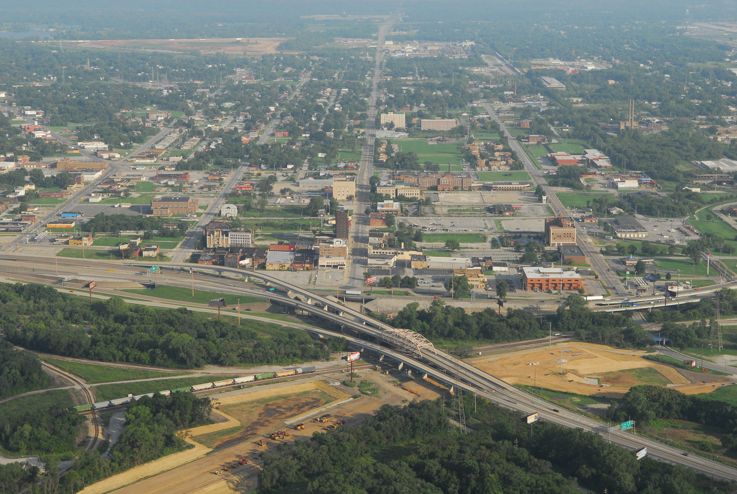


Between East St. Louis’ incorporation in 1861 and 1960, East St. Louis’ downtown business district developed in an area presently bounded by Broadway, Third Street, St. Clair Avenue, and Tenth Street. The distance from the Mississippi River was necessitated by the presence of Bloody Island, which was unsuitable for substantial construction and prone to flooding. After Bloody Island had been connected to the bank, the Wiggins Ferry Company hired the St. Clair County surveyor in 1865 to survey and lay out 734 town lots as the Ferry Addition of East St. Louis. This area never fully developed, and eventually became the site of rail terminals and their yards, keeping commercial development set back from the river.
At the end of the Civil War, business interests looked to East St. Louis as a logical outpost of railroad terminals and manufacturing facilities adjacent to St. Louis. The city’s first real bank was the East St. Louis Real Estate and Saving Bank, founded in 1865 and later known as the East St. Louis Bank. The East St. Louis Real Estate and Saving Bank was located south of the district at Third and Broadway, in a cluster of commercial buildings. One observer proclaimed as early as 1865 that “East St. Louis was losing its rural ambience and was well on its way to becoming the second largest city in the state of Illinois.”
Yet the largest deterrent to East St. Louis’ downtown development in the nineteenth century was flooding, dramatized by the inundation by the major 1844 flood of the bottomlands where East St. Louis would rise. When the Eads Bridge opened in 1874, it logically opened development of downtown parcels now easily accessible to St. Louis. Yet the bridge deposited carriages and omnibuses onto low-lying streets that frequently flooded or remained muddy. In 1875 Mayor John Bowman secured passage by the city’s Board of Aldermen of the city’s first high-grade ordinance, which raised some streets 12 to 20 feet above existing grade and the Flood of 1844 high water mark. However, opponents fearing tax increases successfully filed petitions in court that delayed implementation of the ordinance.
Historian Bill Nunes writes that the first “high-grade buildings” rose in 1876. Seven years later, in 1883, a large fire starting at the intersection of Division and Collinsville Avenues destroyed 22 houses and number of businesses. This fire spurred commercial development on the blocks within the district. Meanwhile, East St. Louis’s population would rise from 9,185 in 1880 to 29,734 in 1900. Development of the downtown area was a key issue in the mayoral election of 1887, with victorious candidate M. M. Stephens championing raising the downtown street grades further. Proponents of raising the street grades generally represented corporate and real estate interests, while opponents were local politicians. Stephens pushed through a $725,000 bond issue in 1887 that funded raising Front Street above the 1844 high water mark so that it could become a levee, and secured funds to raise principal streets 14 to 20 feet higher. Beginning in 1888, downtown streets were raised. Collinsville Avenue was raised in 1889, despite some opposition from property owners. That same year, East St. Louis had 14,272 residents, was noted as the fastest-growing city in the nation, laid its first electric streetcar tracks, and published the first issue of the East St. Louis Journal, a new daily.
The raised streets enabled development of new buildings, and businesses boomed. The East St. Louis Bank became First National Bank in 1890, with expanded lending power. First National and other institutions quickly funded real estate development. The St. Louis Post-Dispatch noted in an August 1892 article that “handsome business blocks” lined the raised streets of Main, Collinsville, Missouri, Broadway, and Third. The article notes that new commercial buildings had replaced vacant lots and houses on those streets. Collinsville Avenue had been raised from Broadway to St. Clair Avenues and had an electric streetcar line; this was the “principal business street of the city, ” according to the reporter. Within the district, Missouri Avenue was lagging behind Collinsville Avenue in new construction but the reporter suggested that it would catch up.
A natural disaster brought rapid change to the emergent business district. A great tornado on May 27, 1896, devastated East St. Louis, causing more than $2 million in property damage and killing over 100. The tornado first hit the ground in St. Louis and passed across the river along the Eads Bridge. The devastation was concentrated downtown, where City Hall was destroyed along with buildings on Missouri Avenue, Main Street, and Collinsville Avenue. Along with the street grade changes, the tornado was responsible for reshaping the downtown area. Today, what remains on Collinsville Avenue represents the trajectory of these events’ consequences—an urban core that later lost its reason for being only to settle into a slower and different economy. This is not really the city’s downtown today. What is Collinsville Avenue now? That question has only a set of possible answers in the twenty-first century.
Excerpted from: Michael R. Allen, "Intangible Heritage on the American Bottom"
Landscape of Fragments and Memories
Parks and Recreations in East St. Louis
Listening to the American Bottom